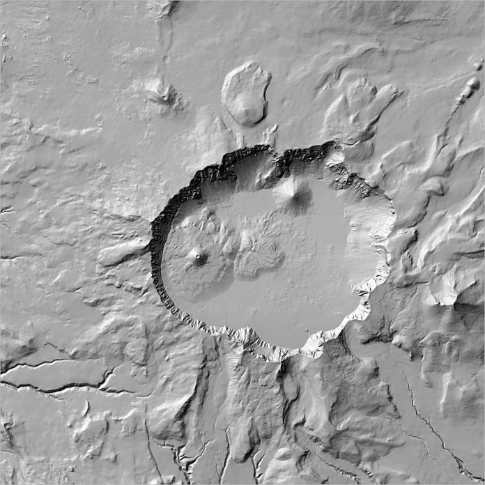
Are you tired of flat and boring maps? Would you like to give your GIS projects a touch of realism and depth? Look no further, because Hillshade ArcGIS Pro is the solution for you! This powerful tool allows you to add shadows and highlights to your maps, creating a 3D effect that brings them to life. Whether you are working on environmental modeling, urban planning or hiking trails, Hillshade ArcGIS Pro can help you visualize terrain features like never before. Keep reading to learn more about this amazing feature and how to use it in your GIS workflow.
What is hillshade arcgis pro?
Hillshade is a technique that simulates the shade and shadows created by the sun’s angle of incidence on terrain features. ArcGIS Pro, a powerful GIS software platform developed by Esri, offers Hillshade as one of its many advanced tools for 3D visualization. This feature uses digital elevation models (DEM) to calculate how sunlight interacts with your map layers, creating a realistic representation of the land surface.
Hillshade can be used to enhance various types of maps, including topographic maps, shaded relief maps or thematic maps. It helps you better understand slope orientation and steepness, terrain ruggedness and vegetation cover. With ArcGIS Pro’s Hillshade tool, you can customize color schemes and lighting settings to achieve different effects depending on your project goals.
In summary, Hillshade ArcGIS Pro is an exciting way to add depth and dimensionality to your projects using real-world data sources such as DEMs. By generating shades and shadows based on simulated light conditions at specific times during the day or year, you can create accurate representations that help viewers visualize landscapes in more detail than ever before.
Overview of Hillshade ArcGIS Pro
Hillshade ArcGIS Pro is a tool that helps you create shaded relief maps by simulating the effect of sunlight on your terrain data. This feature can be found in the Elevation tab of ArcGIS Pro. It uses the elevation raster layer to create a grayscale image that shades areas based on their relative slope.
One advantage of using Hillshade over other shading techniques like hypsometric tinting or contour shading is that it creates a more realistic and natural-looking 3D effect, which can help users better understand the topography of an area.
Hillshade also has several settings you can adjust to customize your map’s appearance. You can control things like sun altitude and azimuth, as well as specify whether shadows should be cast from ridges or valleys.
Another useful feature of Hillshade is its ability to combine multiple hillshades into one layer, allowing for greater flexibility when creating maps with varying levels of detail or color schemes.
Hillshade ArcGIS Pro is an essential tool for anyone looking to create detailed and visually appealing terrain maps. Its customizable features make it suitable for both novice and advanced GIS users alike.
How to use Hillshade ArcGIS Pro
Hillshade ArcGIS Pro is a powerful tool that can help you create detailed and realistic 3D models of landscapes. To get started, first add your elevation data to the map. Then, go to the “Appearance” tab and select “Hillshade” from the drop-down menu.
From here, you can adjust various settings such as azimuth and altitude angles to change the direction of light on your model. You can also adjust the pixel size and cell size to customize how detailed your hillshade looks.
If you want more control over how your hillshade appears, consider using multiple layers with different settings for each layer. This will allow you to create more complex lighting effects and make your model look even more realistic.
It’s important to note that while Hillshade ArcGIS Pro is a great tool for creating 3D models, it does require some technical know-how. If you’re new to GIS or computer modeling in general, be sure to take advantage of online tutorials or seek help from experienced users in forums or other online communities.
Hillshade ArcGIS Pro is a versatile tool that offers many options for customizing and enhancing 3D landscape models. With a little patience and practice, anyone can learn how to use this powerful software effectively!
Conclusion
Hillshade ArcGIS Pro is an incredibly useful tool for mapping professionals and enthusiasts alike. Its ability to display elevation data in a visually appealing way makes it easier to understand the terrain of any given area.
With this tool at your disposal, you can create stunning maps that showcase the topography of your chosen location with ease. Whether you’re creating detailed plans for construction or simply exploring new areas, Hillshade ArcGIS Pro is an essential part of any cartographer’s toolkit.
So if you want to take your mapping skills to the next level and create stunning visual representations of elevation data, there’s no better option than Hillshade ArcGIS Pro!


